Book Review by Somdatta Mandal
Title: A History of India Through 75 Objects
Author: Sudeshna Guha
Publisher: Hachette India
How do you define India to an erudite person or to a layman? This huge subcontinent with its multifarious regions, climate, culture, and history, is simply awesome to define in simplistic terms. Among the different ways in which the history of a nation state can be defined, visual anthropology and ethnographies of material studies for analysing histories of archaeology seem quite unique. This 688-pageA History of India Through 75 Objects by Sudeshna Guha provides a panoramic view of the rich histories of the subcontinent through a curatorial selection of objects from the prehistoric ages through twenty-first century India. It follows the trend of studying ‘object-driven’ history books that has been gradually gaining popularity since the last decade. Doing away with the traditional division of the terms Ancient, Medieval and Modern, they do not constitute historiographic markers of a periodisation. They have been simply used as convenient reference points, and have no bearing, whatsoever, to equivalence with a Hindu, Muslim, or British historical period for India.
It is very difficult to classify the 75 objects described in this book under neat categories. Some of them, like the Eastern Torana of Sanchi, the Ajanta paintings, the Didarganj Yakshi, The Sarnath Buddha, the 11th century Nataraja of Tamil Nadu are well known, but many objects allow us to recall histories that have been sidelined. Thus, the Akluj Hero Stone, Monkey Skull, Pabuji’s Phad painting and Sidi Sayyid’s Jaali in a mosque highlight the histories of pastoralist and tribal societies, oral traditions and slave trade, and the importance of situating them within the mainstream and popular histories of India. For instance, the Jadelite Necklace of Mohenjodaro that is displayed in the National Museum in New Delhi found during the excavations of 1925-26 conveys the erasure of histories in nation-making. The Necklace, divided and restrung into two for India and Pakistan, therefore appears in the book as a historic object affected by the Partition of 1947.
The Chintz rumaal or handkerchief tells the story of the fashioning of a transcultural object and provides a glimpse of the social histories of mercantilism that are often overlooked within the histories of the East India Companies and exhibits the transnational nature of things often used for crafting national histories. Also, the looted and rescued sculpture of the Yogini Vrishanana from the 10th century commands critical enquiries into collecting practices, as they entail removing things from situated places and complicate the issues of securing provenance.
Of the objects that have accrued value as particularly Indian, the Temple Sari, or the ‘Kanjivaram Silk’ to use a colloquial description, documents the invention of old traditions in modern times, while the Ambassador Car highlights the anomaly of heritage making that overlooks the manpower that creates the heritage objects. Non-Indian objects also appear in the book as they relate to histories of India, and one such example is the handheld Tibetan Prayer Wheel which recalls the efficacy of Indians as human instruments in the British imperialist projects of ruling the East.
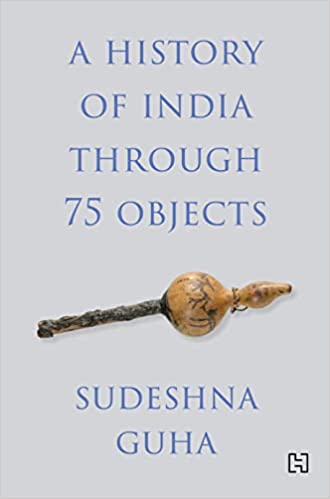
Lesser-known things which feature include an 1857 bed with an image of the Relief of Lucknow, and native histories of antiquarianism, especially of the Mughal emperor Jahangir. Among the ancient artefacts mentioned we have the Pallavaram Spear Head, the Prehistoric Art Gallery of Bhimbhetka, the Sarai Khola Jar at Burzahom, an Indus Scale, a Daimabad Bronze, a Copper Anthropomorph, a portrait of Kanishka I, the Pompeii Yakshi, Samudragupta’s Gold Coin, Fortuna Intaglio, Kharoshthi Tablet and the Chandraketugarh Plaque of Harvesting. One interesting entry comes in the form of a Chenchu Flute (the picture of which adorns the cover of the book too) and this flute evokes the travails and tribulations of the Chenchu tribe, a hunting-gathering and foraging community now living largely in the Nallamala Hills of Telengana who claim inalienable rights to the forest lands they inhabit.
Apart from Garuda’s and Jagannatha’s rathas (chariots), there are several entries that relate to the Mughal times. These include Jahangir’s meteorite knife, a Mughal wine cup, and more. Among books and manuscripts mention is made of the copy of the Ashtasahasrika Prajnaparamita inscribed on palm leaves, Kalhana’s Rajatarangini (where the entire history of the Kashmiri kings, from antiquity to the 12th century is inscribed). The Baburnama, Akbar’s Razmnama, Jatashur, the Millstone of Caste (being one among the sixteen cartoons that were created by Gaganendranath Tagore, one of India’s foremost modernist painters sardonically lampooning the greed, hypocrisy and malpractices of the Brahmins and priests of contemporary Bengal), Bharatuddhar: A Proscribed Print (from a series of prints that were produced in one of the first offset presses in Calcutta in 1930) add to the value of the book. A Kashmiri novel, Munnu is Malik Sajad’s debut graphic novel as a cultural artefact of the political world and is an intensely poignant tale of all the munnus, or little ones, of Kashmir who grow up in war and who hope to forget history that only rationalises the punishments they are subjected to.
Closely related is also the series of ‘Company Paintings’, namely the painting of India commissioned by Europeans from the late 18th century onwards which were done for European consumption and hence obliterated many histories, including those of the contributions of native artists who produced them. The Tanjore paintings that depicts a politically powerless monarch who created the resplendence of Tanjore, and which provides a view of the ways in which collections endowed enlightened powers to their royal collectors also deserves a significant mention.
Several interesting entries relate to popular culture as well. The game board of ‘Snakes and Ladders’, the Godrej Lock (this springless device is still continuously produced till date and in it we see the enduring legacy of the Indian design technology for building a decidedly Indian entrepreneurism), The Quit India Pamphlet (the flyers printed with phrases of Hindi and Urdu prompting reflections of the practices of collecting documentation and archive-making to exemplify the need for careful ethnographies), The Refugee Map (created in December 1941 as a rare surviving example of the shortest and safest routes over land from Burma to India that was most certainly reserved for the exclusive use of the British – their military men and civilians – and the small cadre of European elites who lived in Burma), the LIC Logo (bearing the image of two hands protecting the flame of a diya or an earthen lamp that appear ubiquitous in India and every Indian possibly knows that it symbolizes jeevan bima or life insurance), the Film Poster of Mother India (created in 1980 with the re-release of the film, speaks of an abiding classic that is memorialised to date as a national epic that conveyed the hopes, courage and struggles of the young nation), the many lives of India’s first aircraft carrier INS Vikrant, and the ubiquitous Amul Girl Billboards first created in 1966 (the charming, impish, smart, intelligent moppet in a pigtail and dress of polka dots, she being the only brand ambassador of a product that has also come to represent the uniquely milk-marketing system based on farmer cooperatives), along with the Electronic Voting Machine (the veneration of which as objects to worship, to which one may do puja, illustrates the uniquely Indian social lives of many modern technologies) speak of different kinds of Indian representation in more contemporary times.
The brief essays in this collection detail not just objects but the histories of their reception: examining how with the passage of time people also change their attitudes in responding and interpreting the past. Photographs or illustrations, as well as a list of reference books at the end of each entry, make this volume not a mere coffee-table book focusing on a medley of objects, but a serious academic enterprise as well. Thus, A History of India through 75 Objects inspires us to interrogate our own notions of a knowable past and fixed national history. The essays focus on the continuous processes by which histories are constructed whether the objects are either of value or not. They highlight the inaccuracies of historicising essentialisms, including an essence of the Indian culture and tradition. What is the most unique selling point of the author’s theory is how simple objects often become historical sources and though discussion about each of the seventy-five entries is impossible within the purview of a review, this book definitely guides the reader to see that history is not static but is always in the making.
This volume therefore evaluates in great depth how objects, whether ‘authentic’ or reflected through reproduction or representation, fashion experiential and social effects, thereby highlighting the importance of engaging with their powerful materiality and their multiple and changing meanings in the scholarship of history. Thus, in this superbly arranged and delightfully illustrated book, Sudeshna Guha uses her scholarship and engagement to show how select objects illuminate the complex histories of India. The range of artefacts encompassed here demonstrates that objects’ significance shifts across boundaries, alters with time and place, and can never be reduced to a dominant story of nation or creed. It demonstrates the many ways in which they construct multiple and changing meanings, and thereby illustrates the historic flaw of ascribing immutability to a nation’s history by fixing such a valuation as an innate object of cultural heritage. Once again, we see how with the lithographs, posters, and graphic novels, photographs too bring us to note the inordinate power of visual histories for resisting moves of authoritarianism. A wonderful read indeed.
Somdatta Mandal, critic and reviewer, is a former Professor of English at Visva-Bharati University, Santiniketan, India.
PLEASE NOTE: ARTICLES CAN ONLY BE REPRODUCED IN OTHER SITES WITH DUE ACKNOWLEDGEMENT TO BORDERLESS JOURNAL
Click here to access the Borderless anthology, Monalisa No Longer Smiles